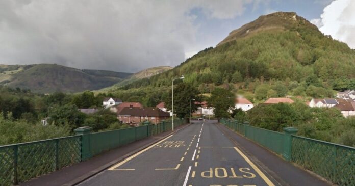
Flooding in Treherbert during Storm Dennis was caused by “significant” surface water from the steep hillsides above the village overwhelming water courses, a report has said.
The council has published its fourth Section 19 Flood Investigation Report following Storm Dennis last year to find out the causes of the flooding, and the latest one focused on Treherbert in the Rhondda Fawr.
It showed that 21 houses were flooded within the local community, along with two businesses with flooding on the highway too.
The report concluded that the weather of Storm Dennis was “extreme” and it is unlikely that flooding could be prevented entirely if a similar event was to occur.
Read more: You can find more of our Rhondda stories here.
Rainfall drained to lower ground via ordinary water courses with many overwhelmed with water and debris and then eventually overflowing and affecting properties, the report said.
The report concluded that the risk management authorities “satisfactorily carried out their functions in response to the flooding, with further measures proposed to better address preparedness and response in future flood events.”
Five culvert inlets were identified as sources of flooding to properties and all five are in private ownership.
Two of the inlets, within the Abertonllwyd Street network, became overloaded in the storm and were identified as being below current design standards.
The remaining three culverts had adequate protection of up to a 1 in 1,000-year storm event with sufficient capacity to manage flows – but this was reduced by blockages, the report said.
(Image: Copyright Unknown)
The council said it has taken 13 actions in response to the flooding, and has proposed doing a further six.
These include clearance work carried out to the culvert inlet structures identified as sources of flooding along with survey work, cleansing and jetting of around 800 metres of the ordinary watercourse network within the investigation area.
It has also started an interim Property Flood Resistance project offering expandable flood gates to those properties deemed at high risk of ordinary watercourse and surface water flooding – and is developing a flood routing scheme along the A4061 (Abertonllwyd Street) to manage overland flows.
The council has also set up an emergency control room bringing together its call centre and CCTV operations to provide a “multi-agency, comprehensive and informed response” in future storms.
The council said it will also look to better understand the catchment around Treherbert by developing a business case to provide recommendations for suitable management systems which will aim to mitigate the future risk of ordinary watercourse, surface water and groundwater flooding locally.
The report has been put together from inspections made by the council’s flood risk management team during the days following Storm Dennis, as well as information from residents, the council’s public health team, Natural Resources Wales and Dwr Cymru Welsh Water.
The council is the lead local flood authority and land drainage authority and has to provide a factual account of what happened in major flooding events.
Following investigation into 28 places affected by Storm Dennis in February 2020, the council will produce 19 reports in total.
This follows two reports published in July 2021, one of which was an overview report which explained and analysed the rainfall, watercourses and river levels experienced across Rhondda Cynon Taf in Storm Dennis and the second was about the flooding in Pentre.
During September 2021, the council published its third report investigating the flooding in Cilfynydd.
To get the latest email updates from across RCT click here.
Credit: Source link


